
Teledyne Geospatial overcomes cost and complexity in aerial topo-bathy survey with the new Fathom coastal mapping solution.
Thursday - 06 February 2025
Vaughan, Ontario, CANADA – February 6, 2025 — Teledyne Geospatial is excited to announce the launch of Fathom, the fastest and most intuitive coastal mapping solution on the market.
Fathom overcomes common challenges related to the cost and technical complexity of topo-bathymetric surveys by leveraging Optech's advancements in sensor miniaturization, real-time processing, and production workflow acceleration. Fathom was developed in response to feedback from government and engineering organizations identifying that crucial geospatial data is missing for the management of resources and infrastructure on land, intertidal zone, and seafloor.
In collaboration with premier geospatial service providers, Fathom incorporates practical features that address the needs of everyday projects and enable organizations to generate new revenue in the coastal market and beyond.
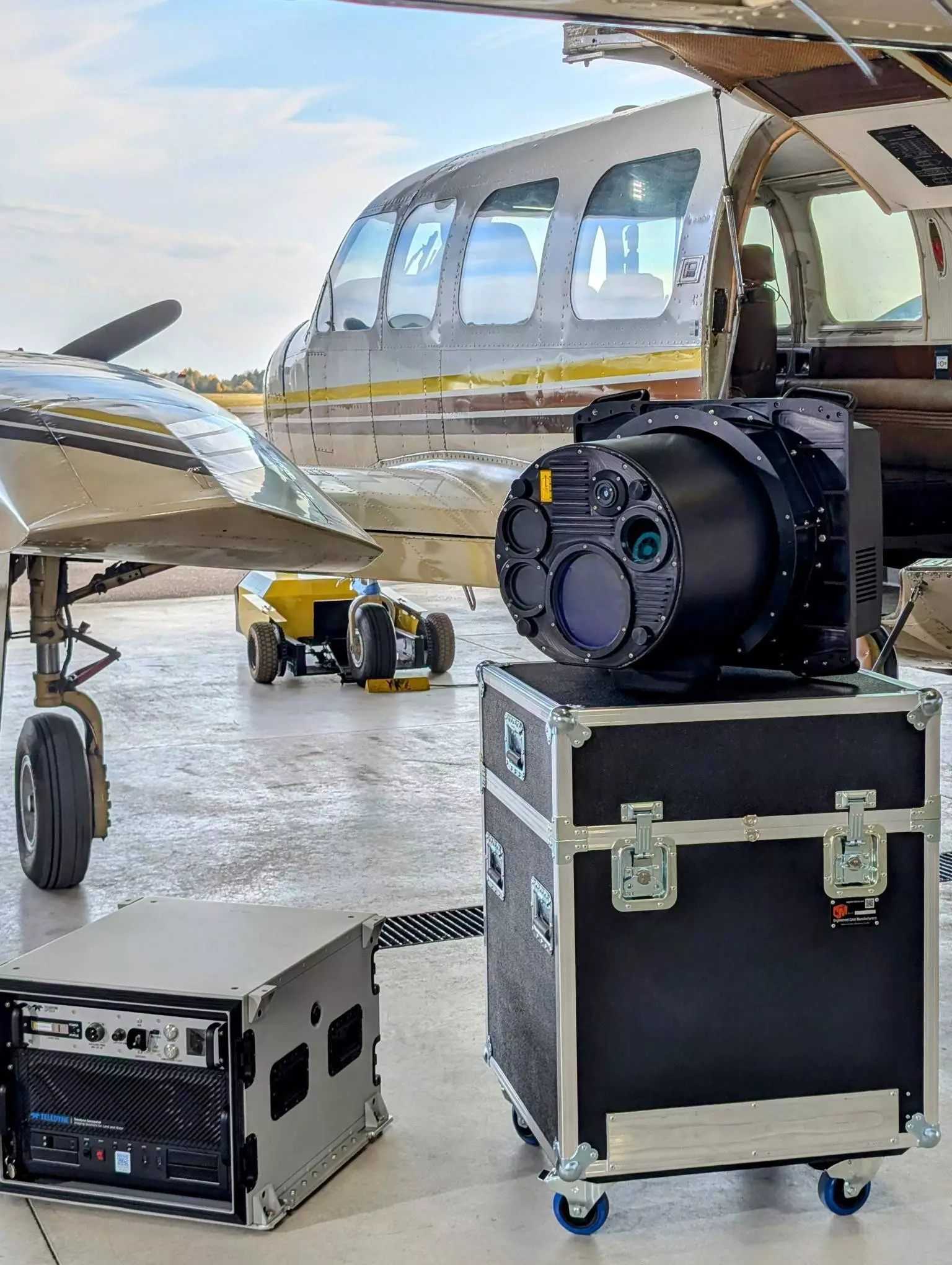
Fathom sensor and Onboard (flight management system, and real-time processing engine) installed in a Piper Navajo.
"Fathom has particularly benefited from the collaboration with SAM LLM who have guided and vetted key aspects of the solution, including its marine depth performance, adherence to USGS topo spec, and the overall turnaround time of lidar and photogrammetric outputs. We are confident in Fathom’s ability to accelerate the capabilities of organizations globally,” said Malek Singer, Teledyne Geospatial’s Senior Product Manager.
Teledyne Geospatial unifies the hardware and software expertise of both Teledyne CARIS and Teledyne Optech. The new group provides customers with innovative integrated solutions. Offerings include turnkey systems, lidar and sonar integrated workflows and a range of systems and solutions that support holistic, precision data collection.
Jennifer Parham - [email protected]